Maps
Other web-building spiders
Overview
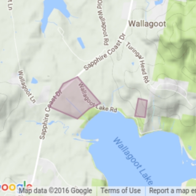
Bega Local Aboriginal Land Council property, surveyed during the Wallagoot Catchment Bioblitz, 4-5 December 2015.
Collection sites were on and around the LALC properties on the Wallagoot Catchment. The outlined areas are an approximate outline of the Bega LALC properties surveyed, not a formal boundary.
Become the first moderator for Wallagoot LALC
Become a moderator
1 species
Land area
68.72 ha
Survey Effort Score (SES)
7
Follow this collection
Receive alerts of new sightings
Subscribe
Filter
-
Local native (change?)
* designates formal legal status
-
Non-invasive or negligible (change?)
Share location
Share link to Wallagoot LALC field guide
How can I use location QR codes?
Your export is being prepared...
We'll email it to you as soon as it's ready.
Note: This process may take up to an hour.
